Table des matières:
Introduction
Amsterdam is a city of canals, bikes, and trams. Whether you’re a tourist or a new resident, finding your way around can be tricky without the right tools. That’s why we’ve compiled a list of the best apps for navigating Amsterdam. These apps cover everything from public transport and cycling to walking and car sharing. In this article, we’ll explore the top options to help you move efficiently and confidently through the Dutch capital.
Why You Need Dedicated Navigation Apps in Amsterdam
While Google Maps works well in many cities, Amsterdam’s unique infrastructure—including dedicated bike lanes, tram networks, and ferry services—requires specialized apps. The best apps for navigating Amsterdam offer real-time updates, offline maps, and local insights that general mapping apps often miss. Using the right app can save you time, money, and confusion.
Top Apps for Public Transport
9292
9292 is the go-to app for public transport in the Netherlands. It covers trains, trams, buses, and ferries in and around Amsterdam. The app provides door-to-door route planning, real-time departures, and fare information. It’s available in English and offers offline access to timetables.
- Real-time updates for delays and disruptions
- Integration with all Dutch public transport operators
- Offline mode for downloaded routes
GVB Travel App
The GVB Travel App is the official app for Amsterdam’s municipal transport company. It focuses specifically on trams, buses, and ferries within the city. You can buy digital tickets, check live departure times, and plan trips using GVB’s network.
- Mobile ticketing with contactless payment
- Journey planner with real-time tracking
- Service updates and alerts
NS Reisplanner
For train travel to and from Amsterdam, the NS Reisplanner (by Dutch Railways) is essential. It covers all NS trains, including intercity and sprinter services. The app also shows delays, platform changes, and alternative routes.
- National train schedules with live updates
- Ticket purchase and seat reservation
- Offline timetable access
Best Apps for Cycling in Amsterdam
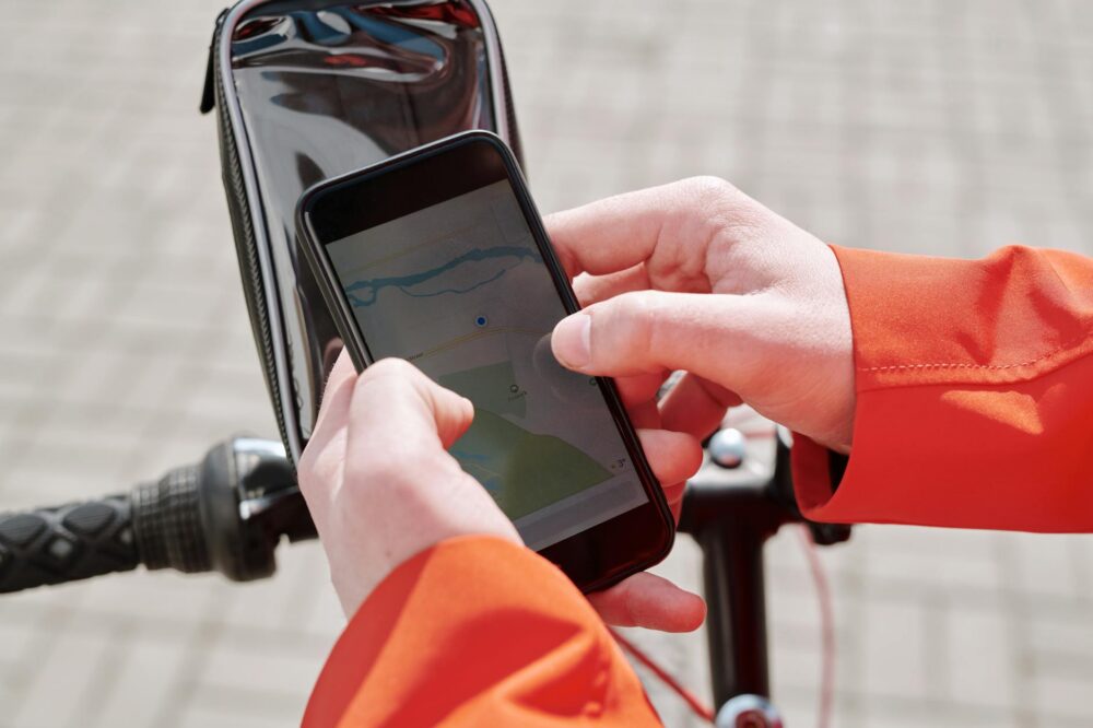
Google Maps (Bike Mode)
Google Maps has a dedicated bike mode that works well in Amsterdam. It suggests bike-friendly routes, avoids busy roads, and estimates travel time. While not perfect, it’s a reliable free option for casual cyclists.
- Bike-specific routing with elevation data
- Integration with other transport modes
- Voice navigation for hands-free biking
Fietsknoop
Fietsknoop is a Dutch app that uses a network of numbered cycling junctions. It’s popular among locals for scenic routes and efficient navigation. The app works offline and includes points of interest along the way.
- Offline maps with junction-based routing
- Customizable route length and scenery
- Integration with other cycling networks
OV-fiets App
If you’re renting a bike from the OV-fiets system (available at many train stations), the OV-fiets App is handy. It helps you find nearby rental locations, check availability, and unlock bikes with your phone.
- Find and reserve OV-fiets bikes
- Digital unlocking via QR code
- Payment integration with your OV-chipkaart
Walking and Exploring on Foot
Citymapper
Citymapper is a comprehensive urban navigation app that excels in Amsterdam. It combines walking, cycling, public transport, and ride-sharing options. The app provides step-by-step walking directions with landmarks and real-time updates.
- Multi-modal trip planning
- Voice-guided walking directions
- Service status and disruption alerts
Maps.me
For offline walking navigation, Maps.me is a top choice. It offers detailed maps of Amsterdam that work without an internet connection. You can save points of interest and get turn-by-turn directions.
- Fully offline maps with search
- Bookmarks and route sharing
- No data usage required
Ride-Sharing and Taxi Apps
Uber
Uber operates in Amsterdam with various service levels, including UberX and Uber Black. The app provides upfront pricing, driver tracking, and cashless payment. It’s especially useful for late-night travel or when carrying heavy luggage.
- Convenient pickup and drop-off
- Estimated fare before booking
- 24/7 availability
Bolt
Bolt is a popular alternative to Uber, often offering lower prices. It covers most of Amsterdam and provides similar features. Bolt also includes electric scooters and bikes in some areas.
- Competitive pricing
- Multi-vehicle options
- Cash or card payment
Ferry and Water Transport
GVB Travel App (Ferry Section)
The GVB Travel App includes ferry routes across the IJ River, connecting Amsterdam Centraal to the north. It shows schedules, waiting times, and service updates for these free ferries.
- Free ferry routes and timetables
- Real-time departure information
- Integration with other GVB services
Amsterdam Water Taxi App
For a faster water journey, the Amsterdam Water Taxi App allows you to book private water taxis. It’s ideal for groups or when you need a direct route across the canals.
- On-demand water taxi booking
- Fixed fares for common routes
- Real-time tracking of your boat
Parking and Driving Apps
Parkmobile
If you’re driving in Amsterdam, Parkmobile helps you find and pay for parking spots. You can extend parking sessions remotely and receive reminders when your time is about to expire.
- Pay by phone for street parking
- Find available parking garages
- Digital parking receipts
ANWB Onderweg
The ANWB Onderweg app provides traffic updates, road works, and fuel prices. It’s useful for navigating Amsterdam’s busy roads and finding the cheapest gas stations.
- Real-time traffic information
- Route planning with incident alerts
- Fuel price comparison
Conclusion
Choosing the best apps for navigating Amsterdam depends on your preferred mode of transport. For public transport, 9292 and the GVB Travel App are indispensable. Cyclists will benefit from Google Maps’ bike mode or Fietsknoop. Walkers can rely on Citymapper or Maps.me for offline use. And for driving or ride-sharing, Uber and Parkmobile offer convenience. By downloading a combination of these apps, you’ll be well-equipped to explore Amsterdam efficiently and stress-free. Remember to check for updates and download offline maps before you travel to ensure seamless navigation.
Photo by Norma Mortenson on Pexels


Is Google Maps bike mode really reliable in Amsterdam? I’ve heard it sometimes sends you onto streets that are not bike-friendly.
Google Maps bike mode generally works well for casual cycling, but it may occasionally suggest routes that miss dedicated bike paths. For more accurate bike navigation, consider Fietsknoop or local apps that use the junction network.
I’m planning a trip to Amsterdam next month. Do I need to download multiple apps for public transport, or can I just use 9292 for everything?
9292 covers all public transport in the Netherlands, including trains, trams, buses, and ferries. It’s a great all-in-one option. However, for purchasing GVB tickets or getting real-time GVB updates, the GVB Travel App is also handy.
Can I use the OV-fiets app to rent a bike if I don’t have an OV-chipkaart?
Yes, you can use the OV-fiets app without a physical OV-chipkaart. The app allows you to unlock bikes via QR code and pay with a linked payment method. You’ll need to register and add funds to your OV-fiets account.
Are there any good offline navigation apps for walking in Amsterdam? I don’t want to use data while roaming.
Maps.me is excellent for offline walking navigation. It provides detailed maps of Amsterdam with turn-by-turn directions, all without needing an internet connection. You can also save points of interest and bookmarks.